Avon surprise (no, not the beauty products)
- Michelle Willhelme
- Aug 2, 2020
- 8 min read

Updated: May 17, 2022
After the success of our last walk, Steph and I, thought we should do another one sooner rather than later as the Victorian Covid crisis was worsening and it was looking like our bushwalking days were numbered (in the short term at least). A work colleague had been a on a motor bike ride around the Upper Maffra/Newry area and came across the Mount Hedrick Scenic Reserve picnic ground. He suggested it looked like a great option for us to explore. Armed with a flyer that Greg sent to me, we planned our third outing and luckily got it locked in for the Sunday before the Stage 3 restrictions came into force for regional areas.
Once again the weather gods were on our side and we were promised a perfect day with a top of 19˚C. We headed off bright and early and already the day was looking good. We had reached the area in a little over an hour (yet another gem so close to home). With the trusty Google maps we headed into the area looking for the picnic grounds that I had been told about. We had picked two destinations for the day, Mount Hedrick and Nicholson Rocks. It seems everyone from the area knows about Mount Hedrick, the Avon River and the Channels, but it seems that Nicholson Rocks is a less familiar destination for locals. It was going to be interesting to see what it was like.
But back to finding the picnic ground. We headed east out of Traralgon on the highway and found our way through Tinamba toward the reserve. Now, we were looking for the picnic ground that was on the west side of Mount Hedrick peak but for some reason, Google took us to the east side. We were pretty excited to come across the entrance to Nicholson Rocks but it made us felt we may have taken a wrong turn because we knew that the rocks were to the east of the peak and the picnic ground to the west. However, we knew that we could access Mount Hedrick from either side so it wasn't really a problem.


Up until this point, the road was gravel but fairly well maintained. We were heading up Kentucky Rd, then took a right turn which we thought was still the same road. Once again we felt we were heading in the wrong direction and soon realised that Kentucky Rd has a sharp left bend that we missed.
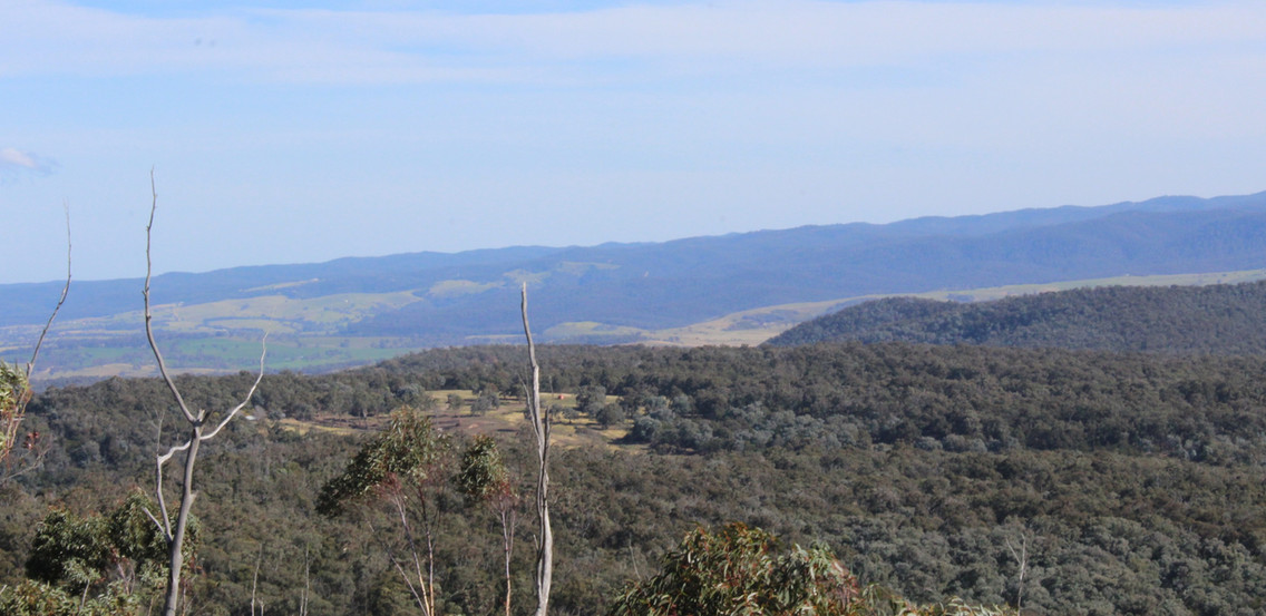
After backtracking to the bend and then continuing in the right direction, just up the hill and around the corner we came to a parking area that is called Green Hill Lookout. From here you see glimpses of the beautiful Victorian Alps.

As we looked over the edge of the picnic area we found a rocky outcrop of large boulders. As I was taking photos I was being drawn down the hill to look at yet another group of interesting rocks. Steph launched her drone to take some overhead shots while I explored what was on the ground.
After our short stop, we were excited to think that we were close to the starting point for our walk. As we headed further along the track, it remained a good width but definitely got rougher. We got to a another parking area to the side of the road, but for some reason, decided this wasn't what we were looking for. Continuing on, we started heading down the hill on a road that was getting narrower and rougher. Thank goodness Steph has a high based 4WD because if we were in any thing less we would have found ourselves teetering the huge humps in the road like some cartoon comedy scene. The clip below is just a little example of the road , however this was a pretty smooth bit. You'll hear me trying to sound frustrated (as a joke) with Steph's driving by asking her to keep the car smooth but I was laughing so much that I couldn't get the words out
We finally came across a creek crossing and it was at this point that we both decided we had come too far. Although we didn't really know where we were, we knew that we shouldn't have to cross a creek. So, with the decision made, Steph made a 47 point turn (that might be a slight exaggeration, it was more like a three point turn) and we headed back the way we came.

On the way down the hill we did come across a few hairy points but going back up they seemed a even more precarious. I sat quietly and remained calm as Steph expertly navigated her way back up the hill. It was only when we reached more even ground that we admitted to each other we were more than a little nervous about her ability to get back up the track. So glad I did remain calm and did not make her more nervous.

After making it safely back to Huggett's Lookout, we realised this was the point we were meant to stop. I have to say, that even though we took a few wrong turns, I have not laughed so much in along time on both the trip down to the creek and back up to the look out. By the time we got back to the lookout both of our cheeks were aching from laughing so much.

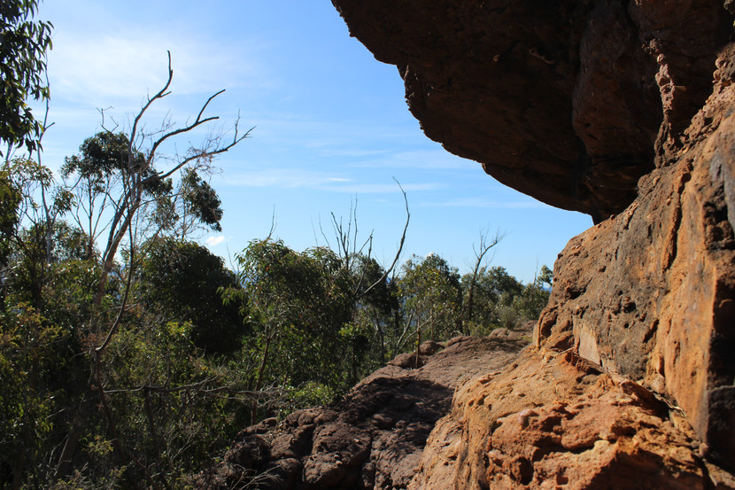
Finally, we got our backpacks out and started along a track to Mount Hedrick. It started out very nicely with gentle slope and a good track with great view to our left. Then it started to get steeper and a lot more rugged. As we slowly made our way up the rocky track we could hear motorbikes off in the distance but they were definitely getting closer. When we had almost reached the top of this track, two bikes came over the crest and luckily they were going slowly and gave us time to move off the track. I assume they made it safely back down the hill because I didn't hear any sirens or helicopters.

Once we got past this point, the track became a lot easier even though the were still steep sections. It was pretty slow going but there were lots of interesting things to see along the way. We came across a section that was pretty rocky and I was about to climb over it when I got the fright of my life because I heard something behind me. Luckily it was just another walker. He looked very experienced as he was kitted out with a full backpack and walking poles. We chatted to him for a while as we walked along the track and found out he was a local who spent a lot of time walking in this area. His name was Michael and he gave us some advice about what to look for so we would know we had reached the peak. Apparently it's not obvious.

Michael forged on ahead and we did our usual stop for photos perched on top of a rock before we headed further toward the peak. About five minutes along the track we came across Michael again. He had decided to wait for us to show us the peak as there is no marker. He was very kind and guided us to the top. We thought he must have been doing an overnight hike as his backpack looked pretty full. He gave us some great advice above packing for day hikes and that we should pack as if we were staying out overnight in case something happened. Our homework during lock down is to do some research on what we should take for future walks.
By the time we reached the top in was time for lunch so we decided to find ourselves a good spot to enjoy some food, the glorious sunshine, the peace and the views. The peace was short lived as a group of about eight arrived a few minutes later. They were really friendly and made they lunch spot a fair way from us so didn't really intrude on our serenity.


If you've read my previous posts you will know that lunch follows international themes and today was recipes from Hong Kong. I made San Choy Bau, and delicious rice noodle rolls (a new recipe, which was a bit time consuming but worth it) with prawn crackers left over from our dinner the previous night and also with some mandarins from my Mum's tree. I think we made one of the ladies from the other group a bit jealous. It was all delicious and I was very happy that I had made the effort (as was Steph). There's something quite satisfying about having a lovely lunch with a beautiful view after a good walk.
With full bellies and lots of photos taken, we started our trip back to the car. The trip back was just as good and even though it was the same path, the different perspective makes it feel quite new. I think there was only one tough section on the way back.


We were quite a way along the track when looking around I couldn't remember seeing the grassy area under the trees when we came up. I mentioned it to Steph but she assured me we were on the right track. A bit further along I noticed another distinctive landmark that I didn't remember. This time Steph agreed but there was nowhere we could think of that we could have taken a wrong turn. All of a sudden we were at the road and hadn't gone back down the rough rocky track we had come up on. Actually, we didn't take a turn that we should have. We realised the point where we had met the motor bikes on the way up was basically and T-intersection of paths, but coming back this original path was not obvious. It turned out the way out was much easier and it meant we had to walk along the road to the car. Thankfully it was all down hill.

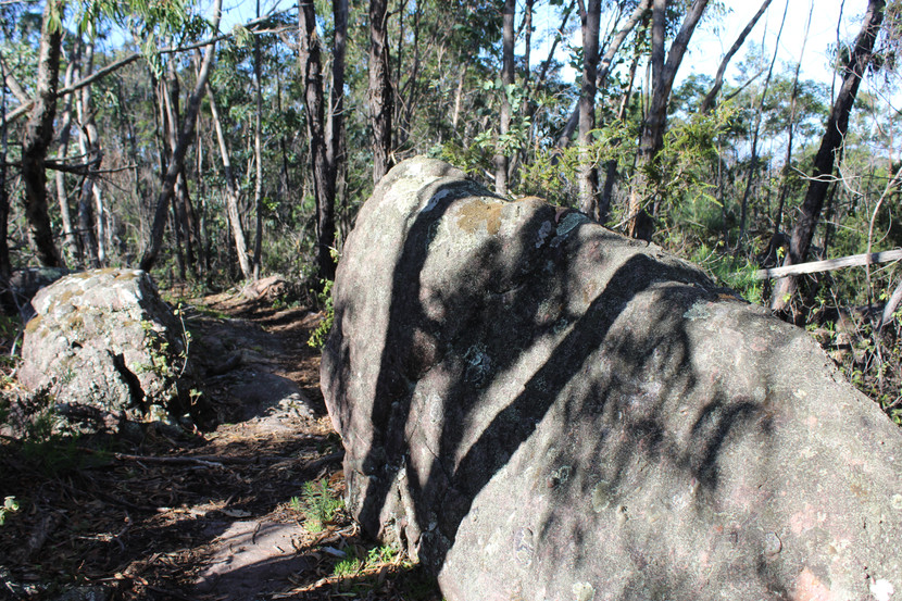
The way back to Nicholson Rocks seemed much shorter than the way in. I'm sure is had nothing to do with all the detours we took. The walk towards the rocks was a completely different landscape. As we wandered down the narrow path, we were surrounded by bracken fern. With the late afternoon sun shining on it, it shimmered silver and almost looked like a layer of snow had fallen upon it.

It was along this track where we found our next face in nature. I think this is becoming a bit of an obsession. As we ventured further along there were signs warning us of a steep cliff edge and it certainly was a sheer drop.

Far down below the creek wound it's way along the bottom of the gorge.

A little further along we faced a large wall of conglomerate rock. After doing a little research on the area (that's how I know it was conglomerate rock which looks a bit like someone has dumped a load of concrete containing lots of pebbles). I found out the the Nicholson Creeks had cut it's way forming this amazing little gorge.
Not far past this wall of rock, we came to an intersection on the path and this takes you down to the base of the gorge. From this point, it became much cooler with the air feeling much damper. The path seemed to cut into the rock face which was a haven for a multitude of fern and orchid like plants that hugged the surface. Another beautiful, almost magical area.


The deeper we went the more moss there was growing on the fallen branches. Down at the bottom of the track was the small creek that meandered down through rocks at the base of the gully. It's a serene place and sitting under the huge overhanging boulder for a picnic would be the perfect spot on a hot summer's day.


We stayed down there for longer than I expected taking lots of photos.

The track back up to the road seemed to be long and steep but I think I was more tired than I realised. We had probably walked about 8-9km for the day which is not much on flat ground and if you are fit, but there were some pretty steep and rocky paths in parts, and it was definitely a challenge for me. When we reached the road again we met a family who had also been down to the rocks. When we mentioned we have done Mount Hedrick as well, they told us we were gluttons for punishment. I didn't think it was that bad, but it did make me feel a bit better about being tired.
Well that's another great day over. It's so exciting to discover all these great places so close to home. I'm just sorry I have not taken the time to explore sooner. I hope the next six weeks goes quickly and we can go back and explore more. I would love to visit the Avon Channels as I've heard they are pretty spectacular...why am I not surprised to hear that.


Comments